
 |
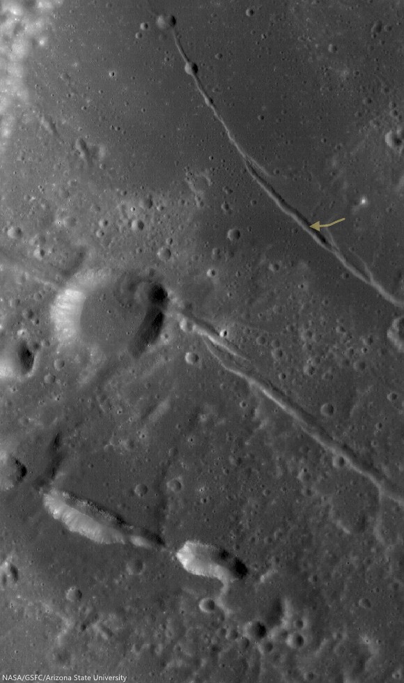
| A rille found on the southwestern edge of Oceanus Procellarum, most likely formed from stress added to the surface as mare deposits were emplaced and cooled. 1200 meter-wide field of view from LROC NAC observation M1145219838R, LRO orbit 20802, January 24, 2014; 36.35° incidence, resolution 1.05 meters from 103.39 km over 0.5°N, 295.29°E [NASA/GSFC/Arizona State University]. |

LROC News System
Remotely sensed data acquired by spacecraft allow scientists to study the geology of other worlds without ever setting foot there.
The investigation of image data is usually the first step in unraveling the origin of a planet’s observed landforms and their evolution -- this scientific study is called planetary geomorphology.
Characterizing geomorphologic features is of the utmost importance for planning both a safely landed mission as well as a rover's path – it would be unfortunate if a rover sent to the Moon got stuck because it was sent to a location it could not traverse. The curved depression in today's Feature Image, called an arcuate rille, is lined with boulders. This is an example of a landing site that would be hazardous for a rover to land in without a very detailed look at the surroundings.
 |
| Location of the area viewed at high-resolution in the LROC NAC Featured Image (arrow) on the unnamed arcuate compression rille that runs almost parallel against Rima Hevelius I, longest of the Rimae Hevelius system and extending outward and beyond Hevelius crater, which is outside this 38 km-wide field of view; north of the pyroclastic vent structures near Lohrmann D. From LROC WAC observation M129716592C, LRO orbit 4249, May 28, 2010; 59.3° incidence angle, resolution 58.61 meters from 42.07 km [NASA/GSFC/Arizona State University]. |
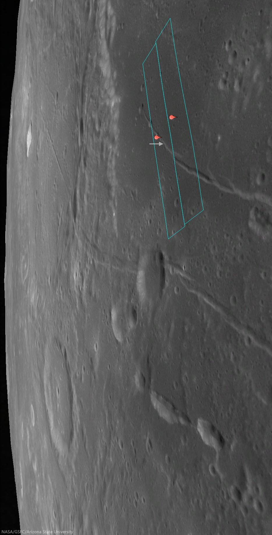 |
| The footprints of the left and right LROC NAC frames, from which the Featured Image was derived, installed on a digital elevation model and LROC Wide Angle Camera mosaic to offer a simulated 'real world' perspective, putting the the arcuate rille area of interest (arrow) in relation to Rimae Hevelius, inside and outside its namesake crater, and the other complexities of the Lohrmann and Hevelius pyroclastic area of the western equatorial border of Oceanus Procellarum [NASA/GSFC/Arizona State University]. |
 |
| The pattern of some of the complexities at the surface of west and southwest Oceanus Procellarum (and a lot of other areas on the Moon) were at least partially laid bare by the sensitive GRAIL A and GRAIL B gravity probes in 2012. Though the exact boundaries and morphology of the vast nearside basalt flood plain are still poorly understood, it's now clearer that the Moon once had its own "Ring of Fire," less dynamic than on Earth, but still a 'squarish' border in the form of deep volcanic rift structures partially surrounding an enormous plate. The inset shows how this system of rifts explains at least some of the surface faulting, the unique mountains and lateral pressures under the Hevelius, Rimae Hevelius, and the pyroclastic vents near Lohrmann D, and, indeed, much of the the western boundary of Oceanus Procellarum [NASA/GSFC/SVS]. |
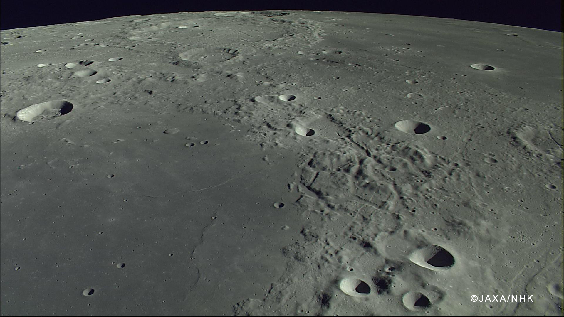 |
| The compression rille is also visible, to the right of the upper center, east of Hevelius, north of the channel linking Grimaldi basin (lower left) with Procellarum (upper right), in this HDTV still captured by Japan's lunar orbiter Kaguya (SELENE-1) in 2007. See the full-size original image, HERE [JAXA/NHK/SELENE]. |
View full-window, HERE.
Related Posts:
No comments:
Post a Comment