
 |
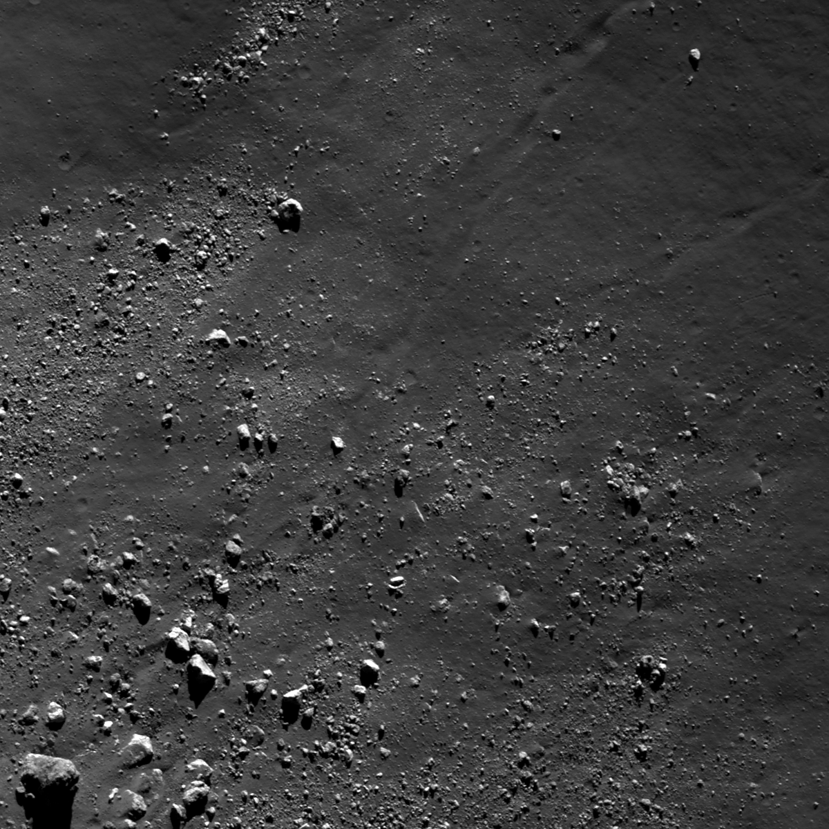
| Boulders greater than 1 meter across, and a few trails, surround the base of a mountain in the Schrödinger central peak ring. Boulder in lower left is around 55 meters across; mountain base is beyond the frame to the lower left. LROC Narrow Angle Camera (NAC) observation M187340587LR, image field of view 732 meters, resolution 0.77 meters per pixel, angle of incidence 79.15° from 36.56 km [NASA/GSFC/Arizona State University]. |

LROC News System
The Schrödinger impact basin is a geologically fascinating location, especially because of the variety of geologic features available for future exploration and it is the second youngest large basin on the Moon (just behind Orientale).
Discussed at length in several other Featured Image posts, blocky material, including boulders greater than 1 meter in diameter, can be used to help unravel geologic stories for an area.
In the case of boulders in Schrödinger, often the boulders originate from regions not easily accessible by robotic equipment or humans. Today's Featured Image highlights a distribution of boulders near the base of a part of the central peak ring (77.196°S, 133.178°E).
 |
| Context for the LROC Featured Image released May 8, 2013 - LROC Wide Angle Camera (WAC) monochrome (604nm) mosaic from 15 orbital passes, just after LRO completed its 10,000th orbit, September 3, 2011. Field of view (see section from mosaic below) roughly 50 km across [NASA/GSFC/Arizona State University]. |
 |
| LROC WAC mosaic covering a quarter of Schrödinger basin, show the 1400 meter high mountains rising over the mare-flooded interior contiguous with the greater peak ring structure [NASA/GSFC/Arizona State University]. |
Today's boulders are derived from the higher elevations of a massif that is part of the Schrödinger central peak ring. Why is this fact geologically interesting? Because central peak rings form during the impact process; as the target is deformed and displaced during impact, material from depth is pushed toward the surface. Central peaks are usually formed in complex craters with diameters ranging from roughly 15 km to 200 km, but when the impact crater is larger than 200 km, central peak rings begin to form.
So, boulders originating from a central peak or central peak ring sample rocks from far beneath the lunar surface. How far? Scientists are not exactly certain, but there are several hypotheses and models undergoing testing with the help of LROC data.
 |
| HDTV still image captured from Japan's lunar orbiter SELENE-1 (Kaguya) in 2008. This oblique view was imaged as the vehicle orbited north, up over the Moon's farside from the far south [JAXA/NHK/SELENE]. |
Can you find a boulder that may be responsible for creating the observed boulder trail in the full LROC NAC image, HERE?
Related Posts:
A review of all things Schrödinger
Craters on the Schrödinger pyroclastic cone
New 3D CLSE flyover video: Schrödinger basin
Sampling Schrödinger
Sampling a Central Peak
Perched boulders
Scarps in Schrödinger
LOLA: Schrödinger Basin
No comments:
Post a Comment