 |
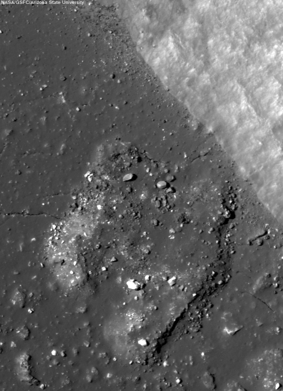
| One side of the floor of La Pérouse A is covered by a landslide of
highland material. 270 meter-wide field of view from LROC Narrow Angle Camera (NAC) frame M152390311L, LRO orbit 7591, February 15, 2011; spacecraft and camera slewed from nadir -8.92° over an angle of incidence of 40.74° Resolution 51 cm per pixel, from 46.56 kilometers altitude
[NASA/GSFC/Arizona State University]. |
LROC News System
La Pérouse A (4.08 km in diameter) is an impact crater located at
9.268°S, 74.705°E. Besides being a fresh, young crater with exquisitely impact melt forms, boulders, and high reflectance ejecta, La Pérouse A is interesting because over half of the crater interior is filled with a landslide of high reflectance material. What set of circumstances would cause a landslide that covers a majority of the crater?
The answer: La Pérouse A is actually lopsided. The impact crater occurred on a slope near the edge of some highland material (possibly old basin ejecta). The northeast rim of La Pérouse A is at an elevation of 1200 m, 920 meters higher than the southwest rim. The northeast rim is not the original rim of the crater, but rather the modified rim after the landslide of highland material into the crater floor. In the Featured Image you can see the edge where the landslide meets the impact melt in the floor of the crater. The landslide makes the final crater diameter larger, and the floor diameter smaller. The angle of the landslide slope ~32 degrees. This angle is the expected
angle of repose for granular material.
 |
| Colorized LROC Wide Angle Camera digital terrain model (WAC DTM), with contour lines. La Pérouse A is in the center
of the white box. Dotted contour lines indicate negative elevations. Area mapped is 75 km across (north is up) [NASA/GSFC/Arizona State University]. |
In the colorized topography figure above, La Pérouse A is in the center. The
contour lines show the steepness of the slopes; the closer together the contour lines, the steeper the slope. Notice how the contour lines for La Pérouse A are much closer together on the northeast side of the crater than on the southwest side. In the WAC context image below, the same area is shown, but the topography is not as apparent. You can see the high reflectance landslide against the lower reflectance impact melt on the floor of La Pérouse A.
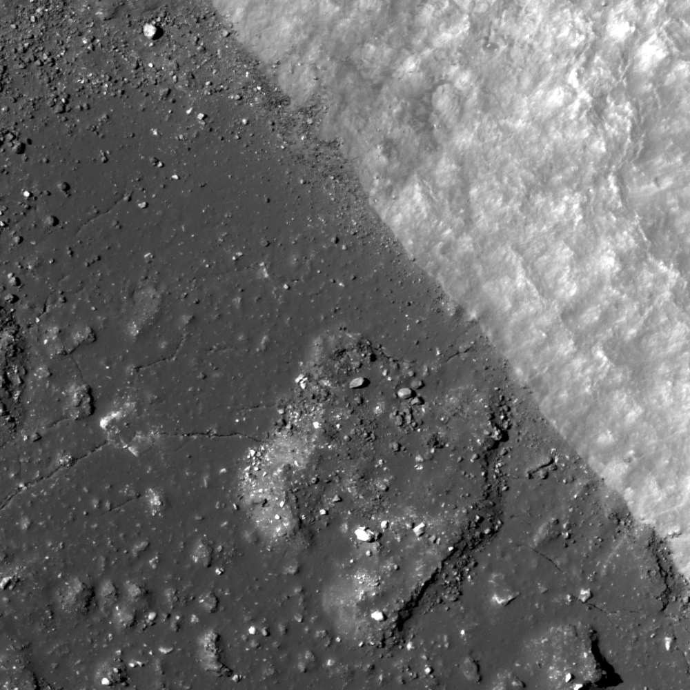
 |
| WAC context image (showing the same 75 km-wide topography as plotted above. The very high reflectance landslide covers more than
half of the crater interior [NASA/GSFC/Arizona State University]. |
Explore the entire NAC frame,
HERE.
Related Images:
Detour!
Lunar Landslides!
Rock avalanche in Robinson crater
 |
| One orbit priot to capturing the LROC Featured Image La Pérouse A crater was imaged, with LRO and LROC NAC more highly slewed from nadir. Mosaic of both left and right frames from LROC NAC observation M152383525LR, orbit 7590, February 15, 2011; resolution 0.56 meters from 46.7 km over the lunar surface, east of La Pérouse A [NASA/GSFC/Arizona State University]. |
 |
| From Earth, La Pérouse A sits in foreshortened glory close to the nearside's perpetual horizon (yellow arrow), a glory of the new, evening Crescent, or "thumbnail" Moon. This particular view from the evening of April 29, 2009, from a mosaic stack of 10 images through the Maksutov-Cassegrain Santel telescope (D=230mm F=3000mm) of Yuri Goryachko of Astronominsk, Minsk Belarus [ASTRONOMINSK]. |


No comments:
Post a Comment